

The integration of Databricks capabilities with geospatial technology marks a significant advancement in the field of geocomputing. By effectively addressing the challenges associated with real-time geospatial data analysis and leveraging cutting-edge technologies, BP has set a new industry standard for enterprise architecture in the energy sector. Led by Steven Bjerring, senior manager of BP’s geospatial oil and gas technology team, the initiative has created an architectural framework that uses advanced geocomputing to improve safety, efficiency and innovation through geospatial data processing.
Challenge: Real-time geospatial data analysis
Meeting the challenge of real-time monitoring and analysis of comprehensive geospatial datasets, including both vector and raster data from sources such as ships, aircraft, radar systems, robotics, sensors and IoT devices; Efficient data ingestion, aggregation and processing was essential to support critical functions such as collision detection, buffer analysis and vessel arrival notification.
To address these complex requirements, BP applied scalable cloud-based architecture and advanced machine learning algorithms to automate anomaly detection and incident prediction across multiple data streams. This initiative prioritized the optimization of data pipelines to achieve low-latency processing, facilitating timely and informed decision making.
Strong data standardization and industry standard APIs enable interoperability, reduce silos, and support security, efficiency, planning, and compliance. BP quickly processed terabytes of raster data for timely analysis.
Solution: Integrating Databricks with geospatial technology
To address these challenges, BP used Databricks features and incorporated them into its geospatial platform, OneMap, resulting in a comprehensive and scalable system. Geospatial data is streamed through the Event Hub infrastructure and stored in an Azure Data Lake environment. This process enables real-time queries and allows concurrent collection of updated geospatial transaction data.
By leveraging Databricks features, BP was able to integrate advanced analytics and data processing capabilities, facilitating faster analysis and improved decision making across various departments. Event Hub acts as a robust data ingestion layer, efficiently streaming large amounts of geospatial data from multiple sources, including IoT devices and remote sensors, into the platform. Once deployed, Azure Data Lake provides a secure and flexible storage solution, allowing structured and unstructured data to be accessed and processed as needed.
Real-time queries empower users to dynamically interact with constantly changing geospatial datasets, supporting applications such as asset tracking, resource management, and spatial analytics. In addition, the system’s ability to collect and update transaction data ensures that all stakeholders have access to the most current information, thereby increasing operational efficiency and being able to respond in a timely manner to emerging trends or events within BP’s global operations.
Here are some major screen shares for example:
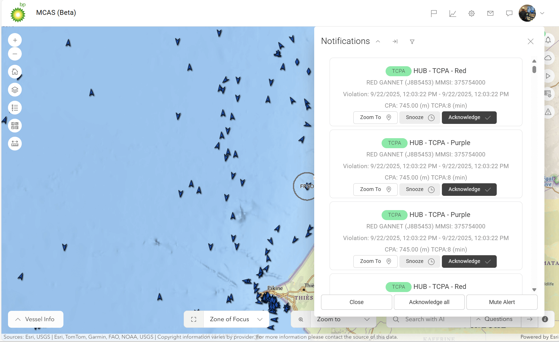
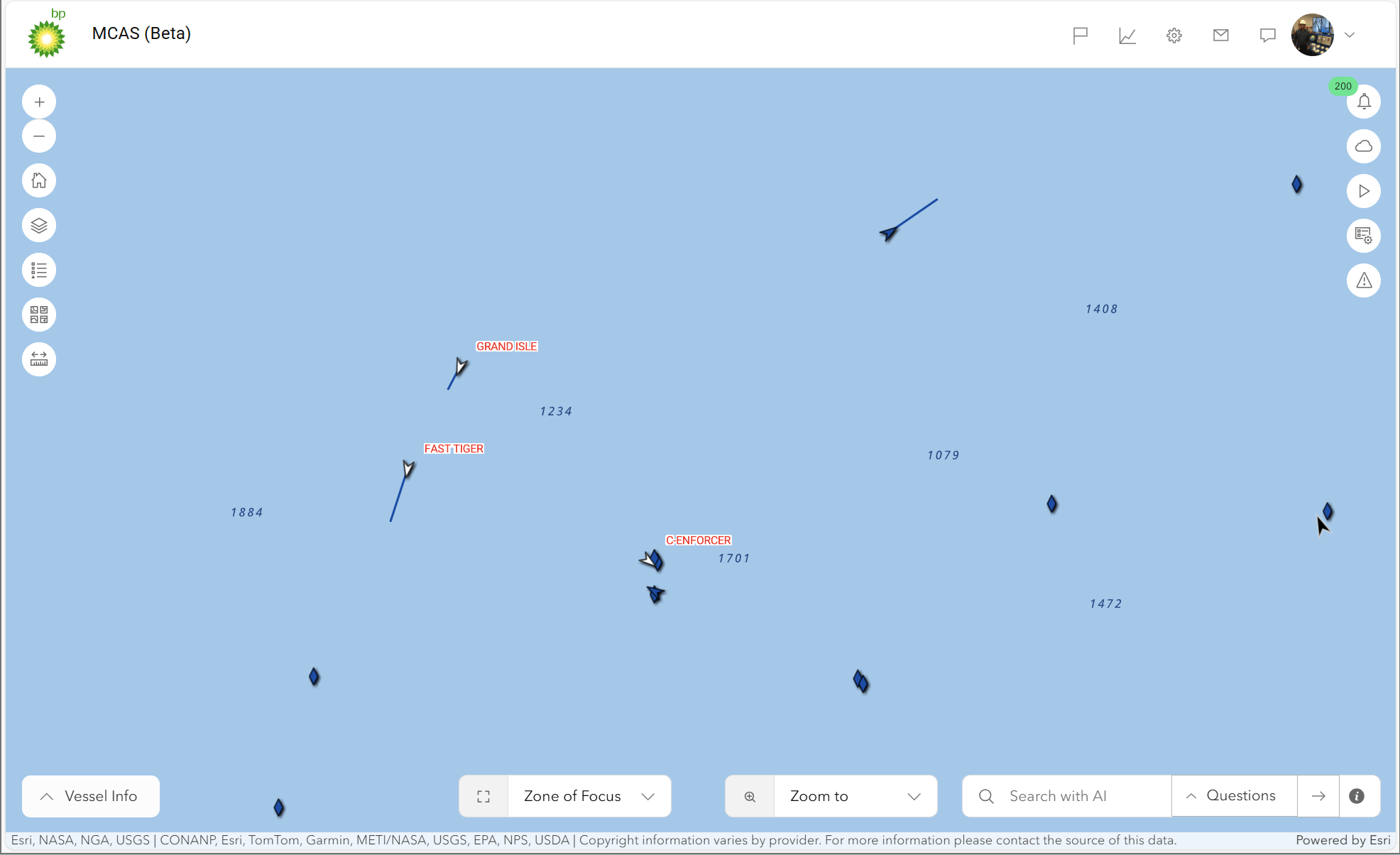
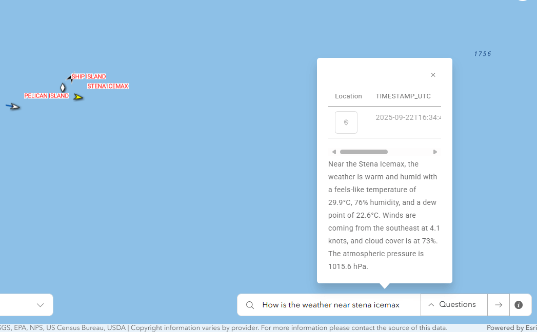
One Map AI Engine: The One Map AI engine serves as the core support for these applications, using multiple workflows to reduce notification and alert noise, aggregate data, and integrate APIs such as weather and radar to provide a comprehensive overview. These demonstrations effectively demonstrate the measurable benefits derived from BP’s strategic technology integration, where advanced innovation meets practical implementation to optimize geospatial intelligence use. The strength of this ecosystem derives not only from its visionary use cases, but also from the flexible architecture and carefully chosen technologies that drive the platform.
The AI underpinning of BP’s solution requires examination of the foundational technologies and architectural principles that underpin this transformative integration.
Key technologies and architecture
The solution leverages several key technologies:
- Databricks: An integrated analytics platform built on Apache Spark, Databricks processes, analyzes, and visualizes large datasets. It provides a collaborative environment for data engineers, scientists, and analysts, offering interactive notebooks, efficient cluster management, and machine learning capabilities.
- Delta Live Table: Constantly updated with real-time streaming data, Delta Live Tables maintain transactional integrity and optimize query performance, allowing seamless integration of real-time data streams into a structured format.
- Kafka Connector (Azure Event Hub): This connector connects Apache Kafka to other data systems, efficiently moving data between Kafka and external sources, increasing scalability and fault tolerance.
- SQL Data Warehouse: Designed for the analysis of substantial data volumes, SQL Data Warehouse employs columnar storage and parallel processing to facilitate fast querying and extraction of insights.
- Databricks Genie: The implementation of GenAI allows our users to connect with this advanced technology through natural language, improving operational efficiency. We designed it to help us spatially query our dataset while returning a natural language response with spatial attributes, which is then used in a widget to integrate with the application to visualize the results.
- Raster Data Processing: Interaction with various Py modules like ArcGIS Py, GDAL, Multispectral Image Processing, etc.
Importance: Advancing geospatial data processing
Steven Bjerring, Senior Manager envisioned an innovative and visionary approach to geospatial data processing that facilitates rapid generation of data, statistics and analysis to solve critical challenges while maintaining low costs, minimizing downtime and ensuring usability and scalability. With BP’s established expertise in big data analytics and the strategic integration of geospatial and platform teams, the organization is well-positioned to drive progress in this area, noted Emeka Emembolu (EVP Technology).
This visionary methodology promises to transform how organizations respond to dynamic environments and complex problems. Using advanced analytics and seamless collaboration between specialized teams, BP can unlock deeper insights into spatial patterns and trends, supporting more informed decision making and optimizing operational performance. The scalable nature of this solution also paves the way for expansion into new domains such as environmental monitoring, infrastructure planning and resource management, ultimately placing BP at the forefront of digital innovation within the energy sector.
Learn how Databricks powers industrial AI